Tusheti National Park
On April 22, 2003, the Parliament of Georgia, with the support of the Global Environment Facility (GEF) and the World Bank, adopted the law on establishing 8 new Protected Areas in East Georgia. Tusheti National Park was among them, created to preserve natural landscapes and wildlife in their original form.
This large and high-lying protected location is now part of the 2020 World Monuments Watch-the list representing a selection of "cultural heritage sites, that combine great historical significance with contemporary social impact" (WMF) but are facing dangers stemming from "encroaching urbanization, political turmoil, natural disaster, and violent conflicts". Through the 2020 World Monuments Watch, World Monuments Fund seeks to contribute to the growth of sustainable tourism in Tusheti, the revival of traditional skills, and to the long-term development of the area in the best interests of its inhabitants.
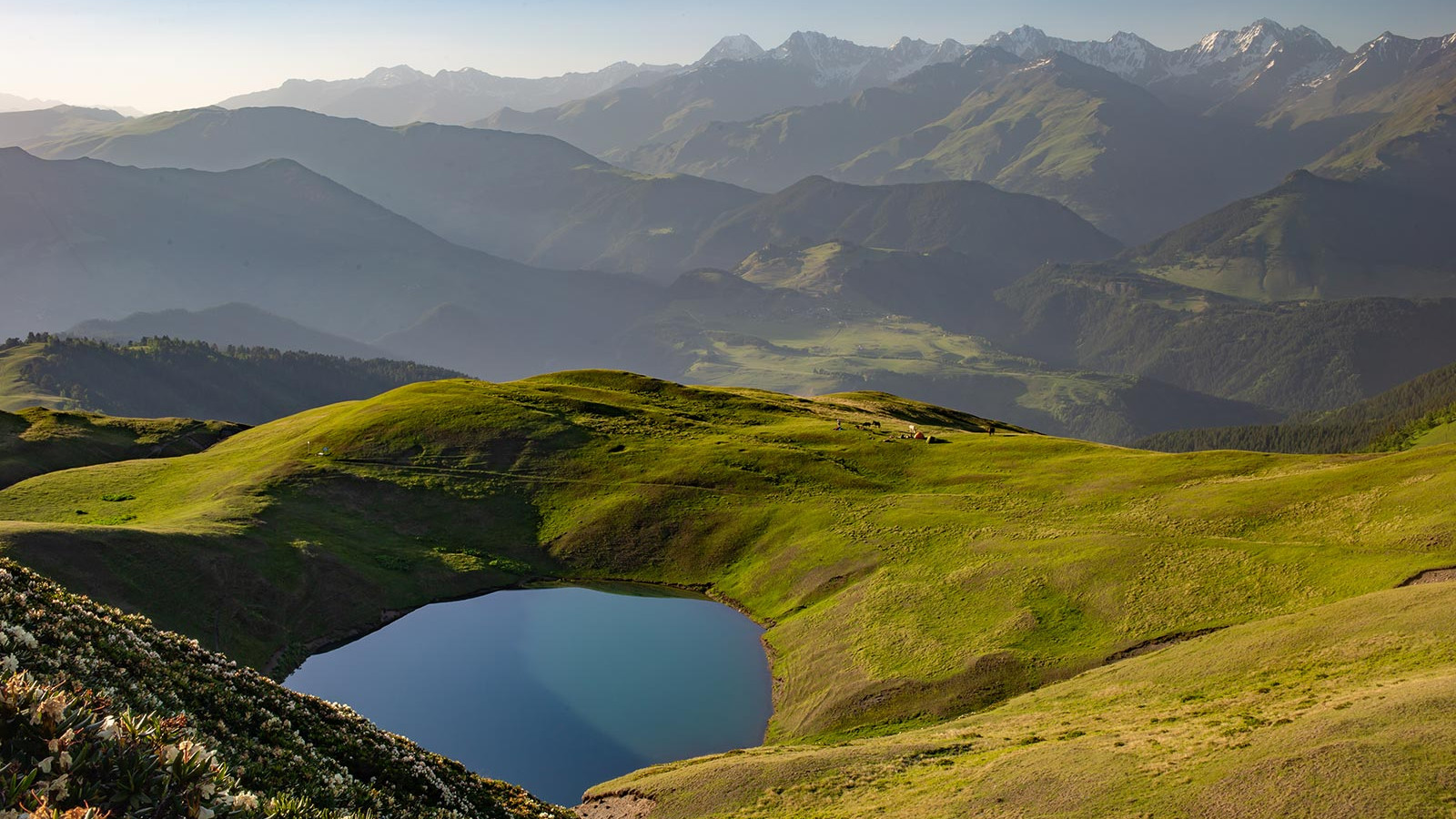
Tusheti Protected Zone stretches across four mountain valleys of Central Caucasus in eastern Georgia and is considered to be one of the biggest (113,660.2 ha) and high-altitude (900-4,800 meters above sea leveland) conservation areas on the territory of Europe. It involves Tusheti State Nature Reserve-IUCN category I (10,694 ha) established in 1981, Tusheti Protected Landscape-IUCN category V (27,903 ha, of which 10% is forest) and Tusheti National Park-IUCN Category II (83,453 ha)-named as one of the “12 best places you’ve never heard of” by BudgetTravel.
Before the highway construction, settlements remained isolated from the rest of the country due to inaccessibility. The only way to reach the region was by helicopter flights. In 1975 Tusheti road was built via Pshaveli-Omalo, but it stays open only from July to September. The rest of the time, the region is isolated because of the snow. Getting here is quite challenging. The narrow road lays on slopes and goes up to 3,000 meters over the gorges of Tusheti. It is considered one of the most dangerous roads in the world.
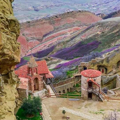
In the park, there are historical villages that preserve unique cultural heritage:
Tusheti is bordered by the Russian Republics of Dagestan from the East and Chechnya to the North. The climate of the mountainous Tusheti region is quite severe. It is never hot here, Spring comes late, Autumn early. From November to spring, Tusheti is covered with snow, while Summer is short and breezy.
Tusheti Protected Areas are characterized by a rich variety of Flora and Fauna and aesthetic terrain.
Flora is distinguished by its diversity with about 1062 species of plants, represented by: Caucasian pine (Pinuskochyana) forest-covering a total area of 15,000 ha, birch trees-Betula litvinovii, B. raddeana (Litvinov birch, Alos Radde’s birch); 230 endemic plant species, from which 11 species are Georgian endemic: Tushetian skullcaps, lily, Tushetianweetbrier, Tebulo buttercup and Tushetian aconite. From Caucasian endemic: Sosnovski pine, Litvinov birch, Radde’s birch, fritillaries, rhododendron, primrose and squill; “Red List” woody species: black birch, Radde’s; 8 Herbaceous species: Erysimumsubnivale Prima, Galeopsis nana Otschiaur, Allium otschiauriae Tscholokaschvili, Ficariavaria Otschiauri, Rosa irysthonica Manden, Jurineaexuberans(Trautv.) Otschiauri, Tragopogonotschiaurii Kuthatheladze.
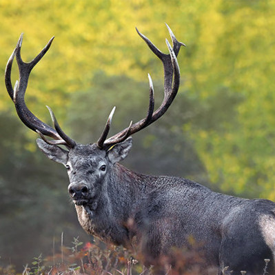
This fascinating place is also home to a rich fauna, with the presence of about 180 species: 60 species of mammals, about 120-birds, 3-reptiles, 6-amphibian, and one species of fish. The wildlife that one might spot here include: East Caucasian tur chamois, wild goat, Caucasian snowcock, roe, lammergeier, deer, Caucasian black grouse, boar, fox, Anatolian leopard (Panthera pardus), brown bear, lynx, chamois, hare, tur; Birds of different size and lifestyle: Bearded vultures, Golden eagles, vultures, mountain kestrel, several kinds of woodpeckers, crossbill, partridge, red head finch, mountain Pipit, buzzard, wallcreeper and the fastest bird on the planet-falcon; Endemic species: Terricola majori, Myotis daubentonii Chionomys gud, Sorex raddei, Chionomys roberti, Sorex volnuchini, Terricola daghestanicus, Caucasian grouse and Caucasian snowcock; 18 Species fom the “Red List” of Georgia (10 birds, 7 mammals and 1 fish): wild goat, Caucasian grouse, brown bear, otter, European barbastelle, tur, deer, Imperial eagle, vulture, greater spotted eagle, black kite, steppe eagle, corncrake, field Montagu’s Harrier, lesser kestrel; Reptiles: Vipera ursine, Coronellaaustriaca, Laerta sp. only one species of the green toad and only one species of fish on this territory - a trout.
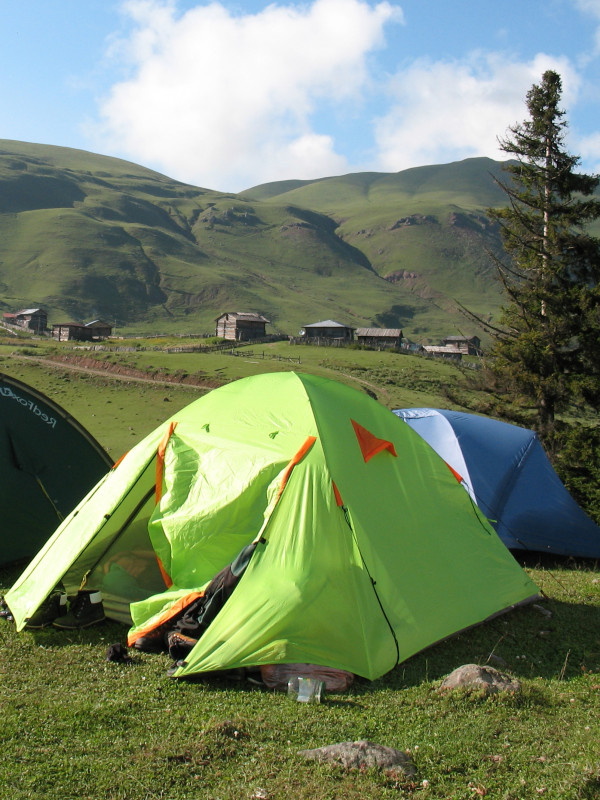
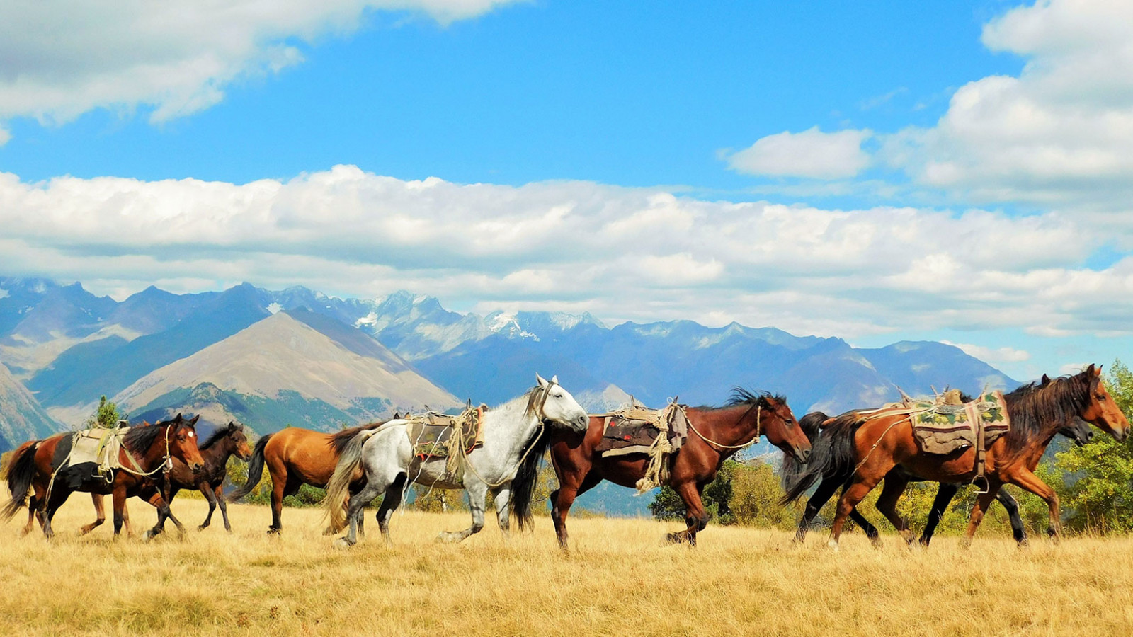
Tusheti Nature Reserve and National Park is managed by Tusheti Protected Areas Administration, located in Akhmeta municipality, village Omalo. The Protected Areas offer a wide variety of tourist services such as: hotels & Accommodation, experienced guides, renting horses and equipment. 11 tourist routes of different complexity operate on the territory, passing through important sights of Tusheti and providing opportunities for the visitors to get acquainted with an intact, wild nature and unique historical-cultural monuments from the past centuries. Almost all the services in the park are free of charge. There are information boards, signs, and paved trails, however hiking in these lands is for physically fit people, who can handle long walks on rough terrain, otherwise, you can opt for a horseback ride.
Tusheti touristic season lasts from June to October.
Currently, there are these tourist trails arranged in Tusheti National Park:
Route 1: Visitor Centre /1 km, 3 hrs, pedestrian, difficulty: easy/
Main attractions: Tusheti Protected Areas Administration and Visitor Centre, scenic viewpoint.
The visitor center is located in the village Kvemo Omalo. In 100 meters from the signboard is situated the administrative complex of Tusheti Protected Areas-one of the most beautiful buildings, surrounded by pine trees. To the east, there is a scenic viewpoint with a breathtaking panoramic view. From here you can see villages: Kumelaurta, Tsokalta, Chiglaurta, and Khakhabo.
In the visitor center, you will get information about the natural and cultural sightseeing of Tusheti PA. The center staff will assist you in planning tours, booking hotels, hiring cars and horses, rent equipment (tents, binoculars, mountain bikes), also offer you a cafeteria and well-furnished rooms. It is possible to use the arranged camping space.
Route 2: Keselo-Kue /10 km, 8 hr, pedestrian, easy/
Main attractions: Village Zemo Omalo, Keselo Fortress, Ethnographic Museum, picturesque landscapes, diversity of bird species, finding and watching bezoar goats.
The trail starts from Tusheti Protected Areas Visitor Centre and through the Village Zemo Omalo, leading toward Keselo Fortress, where visitors can explore the fortress and the Ethnographic Museum in Keselo Fortress.
It is advisable to take the trail in the second half of the day, as there is a greater possibility to see bezoar goats in the evening, between 05:00 pm-07:00 pm. Also, you can come across rare birds of prey and the birds that feast on carrion. Potable water is available on top of village Kvemo Omalo and in Village Zemo Omalo.
Route 3: Dartlo-Kvavlo /25 km, 2 days, pedestrian and horse riding, difficulty: average/
Main attractions: Village Zemo Omalo, Village Dartlo, Dartlo Sabcheo (traditional court), a beautiful fortress of Kvavlo.
The trail starts from the visitor center, passes through Village Omalo, and descends onto Kue, on the crossroad field of Pirikita, Gometsari, and Chaghma communities. From here, via the horse riding trail of Tsitelta pine grove slope, it goes up to Gometsari watershed overpass-to Sakrilobo (gathering) stream, in the direction of Village Dartlo.
An automobile road heads from Village Dartlo up to Village Dano, from where it leads to Village Kvavlo.
Possible schedules of the pedestrian route
Day 1: Village Omalo – Ghele – Village Dartlo. Distance – 12 km, an overnight stay can be arranged at the guesthouses in Village Dartlo. It is possible to set up tents near the village;
Day 2: Village Dartlo – Village Dano – Village Kvavlo. Village Dartlo – Ghele – Village Kvemo Omalo / Visitor Centre (distance – 13 km).
Route 4: Dakuekhi /73 km, 6 days, pedestrian and horse riding, difficulty: difficult/
Main attractions: One of the most beautiful villages of Tusheti, medieval fortresses, picturesque landscapes of Pirikita Gorge and Atsunta Overpass, the habitat of East Caucasian Tur, diversity of birds, Pirikita Khevsureti, and remarkable pieces of mountain architecture – Mutso and Shatili.
The trail starts from the Village Omalo and runs along the automobile road leading toward Dartlo and along the left bank of Pirikita Alazani River. Afterward, the trail continues toward Atsunta Pass, which is located at the crossroads of Khevsureti and Tusheti. One must cross this pass in order to go to Khevsureti. The trail ends in the village of Shatili of Pirikita Khevsureti, from where one can reach Tbilisi by car.
Possible schedules of the pedestrian route:
Day 1: Village Omalo – Village Dartlo, 18 km. Overnight stay is possible at guesthouses in village Dartlo, as well as in tents;
Day 2: Village Dartlo – Village Girevi. 13.5 km. Overnight stay in tents;
Day 3: Village Girevi – Kvakhidi. 16.5 km. Overnight stay in tents;
Day 4: Kvakhidi – Khidotani, overnight stay in tents;
Day 5: Khidotani – Mutso, overnight stay in tents;
Day 6: Village Mutso – Shatili.
Route 5: Diklo
To book private tour, please, follow the link below or contact us here.


 Deutsch
 русский